 |
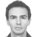
Dr. Vassilia Karathanassi is an Associate Professor in the School of Rural & Surveying Engineering of the National Technical University of Athens. She received an MSc in Rural and Surveying Engineer at the National Technical University of Athens (NTUA), an MSc. in Geography at the University Paris IV, and a Ph.D. in Remote Sensing at NTUA. Since 1998 she has been a faculty member within the Remote Sensing laboratory at NTUA. Her research interests include the processing of multispectral, hyperspectral and SAR data. In recent years, her main research area is SAR and hyperspectral remote sensing. She is the author of more than thirty articles in referred international journals and more than fifty papers in proceedings of international congresses. She has more than 300 citations. She has participated in more than 27 research projects, in many of them as principal researcher and project leader.
|
 |
Dr. Konstantinos Karanztalos
|
 |
Dr. Konstantinos Topouzelis
|
 |
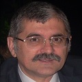
Dr. Polychronis Kolokoussis is a graduate of the Rural and Surveying Engineering department of the NTUA (1993) and a PhD from the same university (2008). Since 1998, he is a senior research assistant at the Remote Sensing Laboratory, School of Rural and Surveying Engineering, NTUA. He participates in lectures on Remote Sensing at the under and post graduate level and has significant expertise in the fields of Photo-Interpretation, Remote Sensing, Digital Image Processing, their applications and their integration with GIS. During the last years his research interest has been focused on acquisition and processing of hyperspectral and thermal remote sensing imagery as well as object based image analysis (OBIA), with emphasis on techniques used for identifying changes and protecting the natural environment. He has published his work in several international journals and conferences, and has participated in more than twenty National and European Research Projects. He is reviewer in a range of international journals of Springer, Elsevier and Wiley Publications.
|
 |
Dr. Charoula Andreou
|
 |
PhD candidate Vassilis Andronis holds a Diploma in Rural and Surveying Engineering from NTUA (1991) and he is a PhD candidate of the Remote Sensing Laboratory of the NTUA. Since 1993, he is senior research assistant at the Remote Sensing Laboratory, School of Rural and Surveying Engineering, NTUA. He participates in lectures on Remote Sensing at the under and post graduate level and has significant expertise in the fields of Photo-Interpretation, Remote Sensing, Digital Image Processing, their applications and their integration with GIS. He has publications in several international journals and conferences, and has participated in many National and European Research Projects.
|
 |
PhD candidate Dimitrios Sykas is a graduate of the Rural and Surveying Engineering department of the NTUA (2010) and a PhD candidate in the same department. He has been a Research Associate with the Laboratory of Remote Sensing, NTUA, since 2010. Since 2013 he works as a Senior Earth Observation Engineer in Planetek Hellas. His research interest include multi and hyperspectral remote sensing (theory and applications) integrated with algorithm/methodology implementation and optimization. He has worked in more than 12 research and R&D programs.
|


